
One of many free campsites along the Great Allegheny Passage and C&O Canal Towpath.
In April 2016, I rode from the Pittsburgh Airport back home to Washington, DC via the Great Allegheny Passage and the C&O Canal Towpath. The overwhelming majority of this route—spanning 300+ miles—is set on lovely, car-free paths and rail trails through the forest, snaking along a series of slow-moving rivers. It's a very easy (albeit sluggish) journey, and a great introduction to bike touring. Here are a few things worth knowing.
There's more than one route to take.
The traditional Pittsburgh-to-DC route is pretty simple to follow, but there are a few spurs, detours, and offshoots that are worth checking out. If you're starting from the Pittsburgh Airport, like me (the train to Pittsburgh gets in at midnight, so I drove my bike up in the morning instead and dropped the car at the airport), then you'll have to bike about twenty or thirty miles to even get to Pittsburgh and the start of the route. The Montour Trail picks up right at the airport and carries you a bit of the way into the city on car-free trails, but it's not particularly well-signed and I seemed to lose it at some point, taking congested and pothole-ridden roads instead.
From downtown Pittsburgh, you'll want to get on the Three Rivers Heritage Trail, a charming walkway right along the water. It's shared with pedestrians, and not terribly long, connecting to the Great Allegheny Passage (GAP) just south of town. The GAP is, in itself, managed by a whole number of different towns and municipalities and districts, so you can expect to get a different sort of feel every leg of the way. Some sections of the GAP skirt up right along the backyards of Pennsylvania towns, others divert you through the main street, and still others keep the trail right along the riverside in lush, wooded forest. It isn't all car-free—at least not yet—and especially at the start of the GAP you'll find yourself sharing the road with vehicles here and there, usually with a pretty unimpressive bike lane underfoot.
Just 182 miles from DC, the GAP ends and the C&O Canal Towpath picks up right where it left off, in the middle of a little town called Cumberland. The C&O has an entirely different feel than the GAP. Whereas the passage brings you past towns, grocery stores, and basic amenities every five or fifteen miles, the towpath is an uninterrupted strip of national park land, so anything needed will have to be procured off-trail, typically a detour of a few miles.
Southeast of Cumberland, just a few miles after passing Little Orleans and heading over Sideling Hill Creek, the C&O meets up with the start of the Western Maryland Rail Trail, a 23-mile paved trail that runs parallel to the towpath. It's every bit as scenic and so much quicker and smoother, and the towpath will still be just to your right. I highly recommend taking the rail trail for its entire length.
Finally, after rejoining the route and bumping along another hundred or so miles toward DC, one could detour either toward the Capital Crescent Trail via the MacArthur Boulevard bike path—which ends exactly where the C&O does but is entirely paved—or take the ferry into Virginia at mile marker 35 (White's Ferry, just a few dollars for a bicycle; ferries running constantly during the day), endure a few miles of busy roads en route to Leesburg, and pick up the paved Washington & Old Dominion Trail through the Northern Virginian suburbs, linking up to the Custis Trail and eventually terminating in Georgetown, just a half-mile from the end of the towpath.
In short, a few worthy routes between the Pittsburgh Airport and Georgetown, DC—paved sections are bolded:
- Montour Trail > Three Rivers Heritage Trail > Great Allegheny Passage > C&O Canal Towpath > Western Maryland Rail Trail > C&O Canal Towpath > Macarthur Boulevard > Capital Crescent Trail
- Montour Trail > Three Rivers Heritage Trail > Great Allegheny Passage > C&O Canal Towpath > Western Maryland Rail Trail > C&O Canal Towpath > White's Ferry > Road to Leesburg > Washington & Old Dominion Trail > Custis Trail
- Or just keep it slow and simple with Montour Trail > Three Rivers Heritage Trail > Great Allegheny Passage > C&O Canal Towpath
Oh, and obviously, you can do the whole thing in reverse too.

The Montour Trail, Great Allegheny Passage, and C&O Canal Towpath; map courtesy of gaptrail.org. Not pictured are the Western Maryland Rail Trail (hugging the C&O east of Little Orleans), the MacArthur Boulevard bike path and the Capital Crescent Trail (picking up within 20 miles of DC), and the Washington & Old Dominion and Custis Trails (crossing into Virginia at White's Ferry and back into DC at Georgetown).
Expect it to take longer than you're used to.
Why all this focus on paved sections and alternate routes? Well, bike touring is typically a slow business. You're carrying lots of weight, you're on wider tires, you're biking for long stretches of time, and you're usually not in a rush to get anywhere. But you're often treated to a gentle reprieve every now and then: say, a downhill descent and a smooth bit of tarmac to coast along. Not so on the GAP/C&O.
It's crushed limestone pretty much all the way along the GAP, at a very gradual incline all the way to the Eastern Continental Divide. That means a lot of pedaling and not so much coasting—none at all, really. There's a really nice drop between Frostburg and Cumberland, and after that it's theoretically downhill, but the C&O is even bumpier than the GAP, with roots and rocks and rubble popping out of the dirt, so it's still a whole lot of friction on one's tires.
It took me four days to complete the 360+ miles from the airport to DC, and that involved some long days of biking. My longest day—100.9 miles—took a full twelve hours, so those hoping for a little more relaxation should budget about a week. Physically, just about anyone is capable of making this journey; mentally, one needs to be prepared to be putting in a whole lot of pedal power without much tangible output. The GAP and C&O are lovely, peaceful, and absolutely pleasant national treasures, but they're far from climactic: you get one triumphant summit about halfway through, and that's simply it.
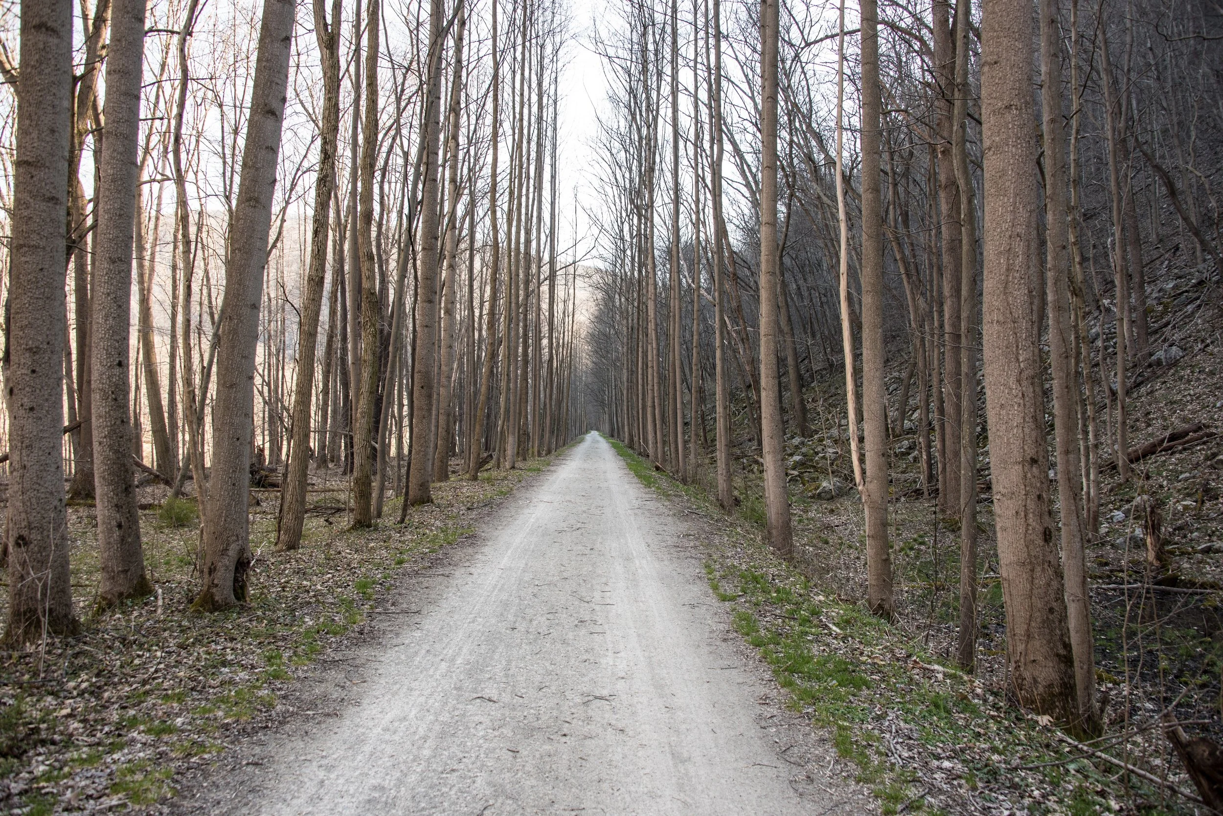
A typical over-the-handlebars view of the Great Allegheny Passage: pretty yet monotonous.
It's better with company.
I love traveling solo. I've spent months at a time doing it, whether scootering along the desolate American southwest or biking over the ridges of the Atlas Mountains. I relish the solitude and the undisturbed views, and there's a whole lot to enjoy about being in nature, just you and a bike.
I did not love solo-biking the GAP and C&O. The monotony of the scenery, however pretty, and the slow pace of the travel, however pleasant, left me feeling a bit bored, and at time I longed for a partner to break up the long, tedious days. The C&O in particular can feel like a driving simulation on repeat: canal to your left, river to your right, gentle bend left, gentle bend right, repeat, and without any little towns to roll through and locals to wave at (for sure, there are some who do make it out to the towpath), it can make the trip something to complete, not something to enjoy.
As always, your mileage may vary. If you want to bike the passage and the towpath and you can't find anyone to make the journey with you, still totally do it—but if you need to wait a week for a friend or lover to be available, you may enjoy it more. Or less. It all depends.
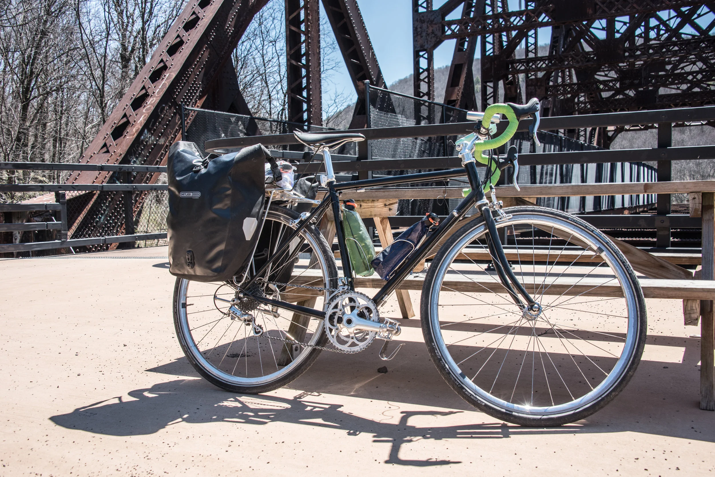
Crossing one of the Great Allegheny Passage's many old rail bridges.
You can do it without spending a cent.
Over the four days between the Pittsburgh Airport and Washington, DC, I spent $31. I wasn't trying to do it on the cheap; it's just an easy place to forget to spend money. Hiker/biker campsites along the towpath are totally free, and those along the passage cost either nothing or maybe $5. Water pumps are available all along the towpath and water fountains at various points along the passage. The $31 I did spend was all on groceries. My biggest expense, indeed, was a one-way car rental to the airport (Amtrak roll-on service wasn't much cheaper, and again, would drop one off in Pittsburgh at midnight), so I suppose it would actually be less expensive to bike to Pittsburgh than to drive there (slower, though).
Four days to a week isn't a terribly long time, so it's certainly possible to pack all the food you'll need before getting to Pittsburgh and just leave your wallet at home (or tucked way down in your pannier).
You're ready to go, right now.
Pack a few spare bolts for the bumpy roads, print out this super-useful listing of services by town, strap whatever you think you'll need to whatever bike you have however you can, and you'll be all set. This tour doesn't require stellar physical fitness or specialized bikes or a fancy GPS unit or alpine clothing or an intricate knowledge of the places you'll be going—just a bit of endurance, a good attitude, and a water bottle. Have fun!
Of course, if you really want to know anything else about the trail—any of the trails mentioned above—drop a comment below. Thoughts of your own? Please share 'em!
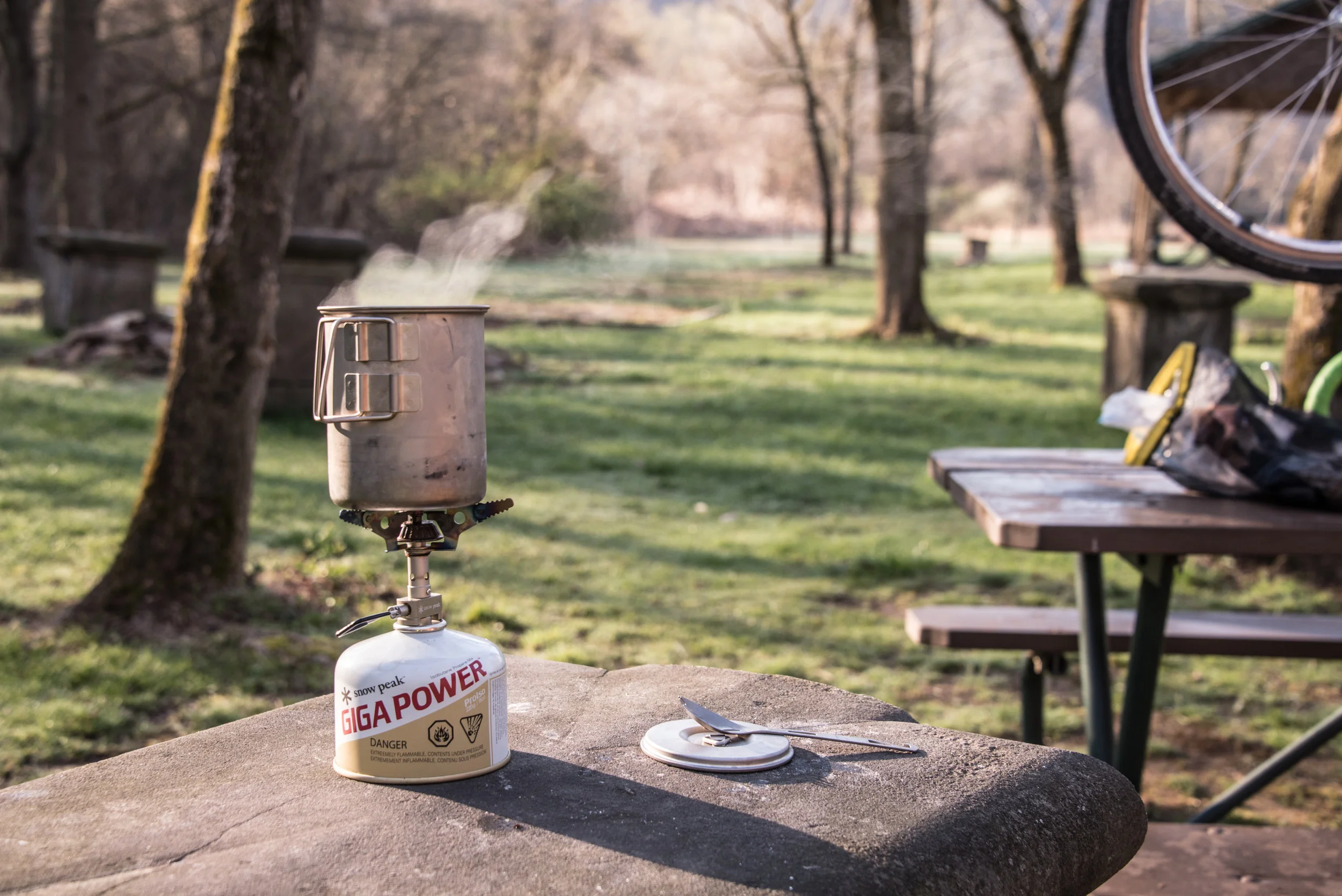
Enjoying a cup of tea after a long day of cycling the Great Allegheny Passage.